The study of the sensitive soil and inflowing river indicators that related to watershed NPS pollution obtained some achievements
In recent decades, the non-point source (NPS) loading becomes the priority source for serious water pollution in many catchments (Evanylo et al., 2008; Yang, 2009), resulting in lake eutrophication, which has become one of the most threating water environmental problems. Therefore, understanding NPS pollution load feature and the main control factors is of great significance for the protection of the watershed environment.
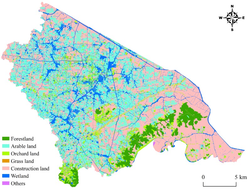
Under the funding of NSFC, the researcher of Remote Sensing Lake group (www.rslakes.com) integrated the remote sense, GIS spatial analysis, physical modeling and field sampling technologies together, and the watersheds that consistitued by Liangxi River and Yangxi River, which were located around the Meiliang Bay and Zhushan Bay of Taihu Lake, were generated in GIS. The objectives of the study were: i) assess the watershed P and SOC loss status based on the model that considers both dissolved and particulate loads together; ii) Determine the critical indicator that is sensitive to the NPS SOC and P loads from numerous related inflowing river indicators and soil properties. The results of the study can be concluded as: 1) Dis-OC was the main NPS OC load fraction, while the contribution of Sed-OC should not be neglected due to a peak value of Sed-OC that was significantly higher than that of Dis-OC in different seasons. 2) particle P loads should be considered as predominant factor, especially in agriculture regions. However, under the process of urbanization and climate change, the factor of dissolved P loads should be increasingly taken into account in the total P loads pollution. 3) The lignin showed a strong correlation with both Sed-OC and Dis-OC loads, but nevertheless, its content in inflowing rivers was extremely low. Interestingly, the CDOM and DOC were well linked with Dis-OC fractions, but POC failed to correlate with particulate organic matter loss, possibly because not only the POC but also the sediment was the ultimate fate for watershed particulate organic carbon delivery. Currently, the study efforts were published on several SCI indexed journals including Ecologcial Indicators and Journal of Environmental Informatics.
The map of land use patterns